Dominica is often confused with the Dominican Republic, but the only connection between the two states is that they are in the Caribbean. this is something completely different. Dominica’s economy consists largely of agriculture. Most of the farmers live here from growing bananas. Many Europeans eat these yellow, sweet fruits from Dominica.
The biggest factor of uncertainty for the Dominicans is the weather. The one-sided cultivation of bananas does not make it easy for the people of Dominica to survive. According to calculatorinc, Dominica exports a lot of bananas, but if the weather does not play along for a season, the whole harvest is in danger and with it the income of most of the residents. The hurricanes that repeatedly sweep over Dominica are also a problem. They leave havoc and destruction, and it is not uncommon for them to kill the harvests. As a result, the existence of the Dominicans is constantly under threat.
There are some international funding projects that want to bring people closer to alternative food supplies. Nowadays Dominica tries above all to promote the construction industry and tourism.
Dominica – key dates for your trip to the Caribbean
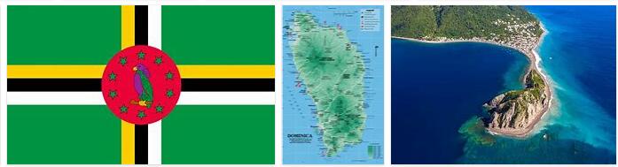
Area: 754 km²
Population: 72,969 residents (July 2011, CIA)
Population density: 97 residents per km²
Population growth: 0.214% per year (2011, CIA)
Capital: Roseau (16,580 residents, 2006)
Highest point: Morne Diablatins, 1,447 m
Lowest point: Caribbean, 0 m
Form of government: Dominica is a republic represented in the Commonwealth. The constitution dates from 1978. The unicameral parliament consists of 9 appointed and 21 elected members. Dominica has been independent from Great Britain since November 3, 1978.
Administrative division: 10 parishes: Saint Andrew, Saint David, Saint George, Saint John, Saint Joseph, Saint Luke, Saint Mark, Saint Patrick,Saint Paul and Saint Peter
Head of Government: Prime Minister Roosevelt Skerrit, since January 8, 2004
Head of State: President Eliud Williams, since September 17, 2012
Language: The official language in Dominica is English, the colloquial language is a French-influenced Creole (patois). Cocoy, an English dialect, is spoken in the region around Marigot and Wesley.
Religion: Mostly Roman Catholic (61.4%). In addition, Adventists (6%), members of Pentecostal churches (5.6%), Baptists (4.1%), Methodists (3.7%), Rastafarians (1.3%) as well as Jewish, Muslim and Hindu minorities.
Local time: CET – 5 h. There is no change from summer to winter time in Dominica.
The time difference to Central Europe is -5 hours in winter and -6 hours in summer.
International phone code: +1 (767)
Internet ID:.dm
Mains voltage: 220/240 V, 50 Hz. Since American plugs are widely used, an adapter is necessary.
Dominica – geography and map
Dominica is located in the south of Guadeloupe and in the north of Martinique. The island was part of the British colony of the Windward Islands in the past. Nowadays, however, Dominica is geographically more correctly counted among the “Leeward Islands” (in German islands over the wind). But since the border between the northern Leeward Islands and the southern Windward Islands can be drawn differently, the exact assignment of Dominica is still difficult.
The third largest island in the Lesser Antilles is approximately 62 ° west longitude and 15 ° north latitude. It owes its name to Columbus, who named it after the day it was discovered, Sunday November 3, 1493 (Latin “dominica” – day of the Lord).
Dominica is often referred to as ” nature island ” due to its diverse tropical flora and fauna. In contrast to the other islands in the Caribbean, the original vegetation has largely been preserved, as the mountains largely exclude agricultural use. These natural resources are protected by an extensive nature park system. On the mountainous island you will find several of the highest mountains in the Lesser Antilles, more than 300 rivers and streams and numerous lakes (e.g. Boeri Lake).
Dominica is of volcanic origin, in the interior of the country, the volcanic peaks, eroded by weathering, reach heights of over 1,400 m. The highest elevation is the 1,447 m high Morne Diablotins (after the active volcano Soufriere on Basse-Terre (Guadeloupe), the second highest mountain in the Lesser Antilles and one the highest Caribbean peaks). The mountains usually drop steeply towards the coast.
Dominica – Landmarks
Dominica has a wide range of activities for tourists as well as various sights.
This is how Road Imperial should be seen. This is a road that leads through an extremely interesting landscape.
But the Indian River is also worth a visit, as it is great for bird watching. Those who like to be on the water should take part in the Island Style Fishing Whale Watching & Charters.
Jakob Flats is a hiking trail that is also good for swimming. Those interested in birds should take part in the Kens Hinterland Adventure Tours. For anglers it is recommended to see the Layou River. The Layou River Gorge is an interesting looking geological formation. The Spanny Falls is also great for hiking.
But if you are more interested in nightlife, you should visit the club or the Spiders bar. The Cabrits Historical and Marine Park is a historic arenal that everyone should visit. Ticou Gorge is one of the most famous sights. This is a waterfall with interesting geological formations.
The Wale Shark Reef is a recommendation for divers as there is a colorful underwater flora and fauna to discover. Likewise the Castaway Reef.
There is also the possibility of whale watching on Dominica.
Dominica has that water sports enthusiasts, from diving to sailing, have many opportunities to pursue their hobby. Sports activities from hiking to golf or tennis are also possible on the island. Dominica also has an interesting nightlife to offer, as well as many historical sights, whether they are of natural origin or created by human hands.